05/12/2024
Event Summary: Overview of water quality modelling projects from the Queensland Water Modelling Network with Callym Dunleavy
Read more
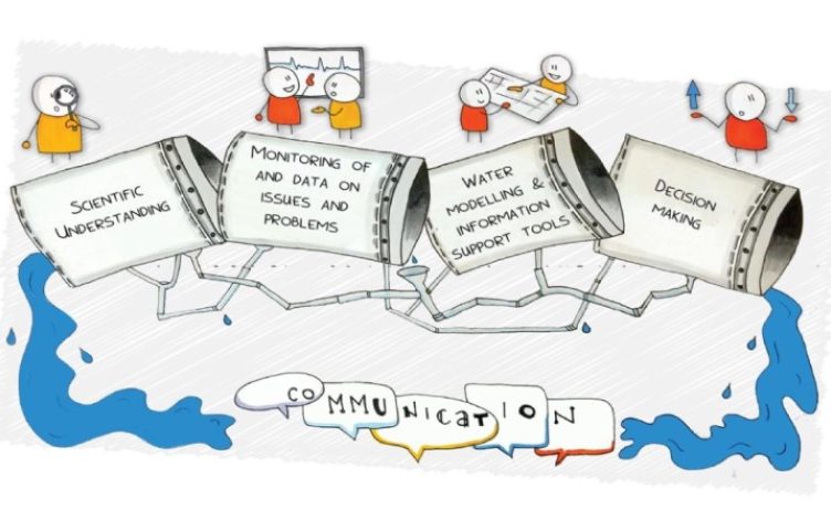
The QWMN aims to be responsive to requests on ways that water management challenges can be better supported through the results and outputs that water modelling can provide. So when colleagues began asking about the role and feasibility of remote sensing as an data input option for water models, to capture the features, behaviours and extent of the extensive landscapes in Queensland other parts of Australia, it appeared we had a good issue to explore.
At this years February 2020 Forum, Tim Malthus from CSIRO provide an overview of what is now available with remote sensing. So building on this perspective and also a Queensland track record of remote sensing in various vegetation management, land use mapping and a suite of other landscape scaled research investigations a recent LiveStream event on Thursday 28 May was held.
The event attracted 130 participant, with a strong from Queensland State Agency colleagues in DES, DNRME and DAF and along with research investigators these were the two largest groups. Participants joined us from right around regional Queensland – such as Gold Coast, Toowoomba, Rockhampton, Mackay, Townsville, Charters Towers and Richmond as well as Sydney, Melbourne, Canberra and Armidale. In addition, we had 11 overseas participants. View the participant profile here.
At this LiveStream event, an overview of the role and accessibility of remote sensing was shared along with 2 case studies showing the application of remotes sensing in land and water management. They were:
Also, in advance of the event and during the introduction Alex Loy Science Leader – DES – provided an introduction on why he as a practioner is eager to more readily access and use remote sensing in his water modelling endeavours
To watch the presentation please go to:
https://watercentre.zoom.us/rec/share/vulFHqPgtVJJRNLxwX2cWvMgI6f3T6a81iQc-KAJy0kbraDrLifVZl5SFKnO24wX
Password: 1Q%TE1G+ (if it says not correct – type in the phrase rather than copy & paste)
Other information shared during the event include:
Participants responses to pre event survey on their interest in remote sensing – details click here
Chat questions, comments and responses raised during the event – details click here